
There’s nothing better than an outdoor adventure, especially in a place as amazing as Bend, Oregon. But, when you only have a limited amount of availability to enjoy the great outdoors, you don’t want to waste your precious time researching trails when you could be out hiking.
With so many great hikes to choose from in the Bend, Oregon region, it’s easy to be overwhelmed by all the options in front of you. Thankfully, we’ve got all the information you need to ensure that you find a great day hike near Bend for your next day off.
Coming up, we’ll give you a sneak peek into nine of our absolute favorite trails in the greater Bend / Central Oregon area, complete with beta on the difficulty of each hike. What are you waiting for? Let’s get to it!
The 9 Best Hikes Near Bend, Oregon:
1. Tumalo Falls


If you generally ignore TLC’s advice and go chasing waterfalls, you won’t want to miss this hike to Tumalo Falls. This 7.0-mile roundtrip hike starts in the busy Tumalo Falls Trailhead parking lot getting amazing views right off the bat. Follow the North Fork Trail upward along a meandering creek.
Along the way, you’ll get nearly constant views of the 90-foot Tumalo Falls as it cascades over its basalt bedrock. Eventually, you’ll leave the Middle Fork of Tumalo Creek behind until you get to see Tumalo Falls up close and personal.
Once you reach the falls, take a moment to sit back and enjoy the power of the water rushing through this amazing feature. Then, you can choose to reverse your steps and return via the same trail or you can take a loop across the City of Bend Watershed.
The loop trail is nearly the same length as the out-and-back alternative but is generally free of large crowds. Just keep in mind that you can’t bring dogs on this section of the trail. If you opt for the loop trail hike, you’ll get a chance to see one more waterfall, but this time without all of the other hikers.
A great hike for families and individual hikers, alike, the Tumalo Falls is a great moderate jaunt in the woods with fantastic views!
Distance: 7.0 miles
Elevation Gain: 1460 feet
Difficulty: Moderate
Learn more here
2. Green Lakes Hike


Waterfalls and scenic views are the name of the game on the Green Lakes Hike. This 8.4-mile moderate out-and-back hike takes you past a series of beautiful waterfalls along Fall Creek as you slowly but surely make your way up into the alpine.
Soon enough, the trail and Fall Creek ease off a bit in elevation, bringing you to about 6000′, where you’ll find a nice alpine meadow to relax in. After the meadow, you start climbing yet again up a couple of switchbacks up to the Green Lakes area.
The Green Lakes area is home to a handful of lakes that were split apart by volcanic sediment left behind during a past eruption. An incredibly popular area, the lakes have great views of and hiking access to both South Sister and Broken Top, which makes them an ideal camping location.
Since the Green Lakes area is so popular, camping is only allowed within designated areas, and you’ll need a Northwest Forest Pass to park at the trailhead. But, for a moderate-length day hike into the alpine near Bend, you really can’t beat the Green Lakes Hike.
Distance: 8.4
Elevation Gain: 1150 feet
Difficulty: Moderate
Learn more here
3. South Sister Summit Hike


As the highest peak in the Three Sisters Wilderness and the third highest summit in all of Oregon, the South Sister is a popular mountain objective for outdoor enthusiasts in the Bend region. The South Sister is unique in Oregon as it has glaciated slopes but doesn’t require any technical climbing gear to get to the summit via the regular hiking route.
That being said, even though you don’t need to be a mountaineer to get to the top of the South Sister, the trail itself is very steep and, as with anything in the alpine, the weather can change drastically in an instant. So, if you’re looking to climb the South Sister, be prepared with spare layers, emergency gear, and plenty of food and water, whatever the conditions.
Also Read: How Long Is The Hike Up South Sister Mountain?
The most popular route up the South Sister starts at the Devil’s Lake Campground off of Highway 46. From here, you cross the highway and hike up and out of the forest to the base of the mountain. After breaking out above treeline, hikers make their way up a long ridge, over a false summit, and then eventually into South Sister’s true summit crater. At the top, unparalleled views and panoramic vistas await!
Distance: 12.2 miles
Elevation Gain: 4898 feet
Difficulty: Hard
Learn more here
4. Todd Lake Trail


If you’re looking to take it easy in the backcountry while still enjoying some spectacular views, the Todd Lake Loop Trail is a fantastic option. This 1.7-mile loop is just a short drive from Bend and provides outdoor enthusiasts with a nice jaunt in the backcountry.
The hike itself starts near the Todd Creek Trailhead, where you can walk a short distance toward the Todd Lake Campground at the south end of Todd Lake. From here, a nice, mostly flat trail wraps around the lake, bringing you back to your original starting point.
The Todd Lake Trail is a great hike for families but is best completed from May to October, due to high snowfall in the region. Additionally, anyone parking at the trailhead needs to pay the $5 fee or have a Northwest Forest Pass (or equivalent).
Distance: 1.7 miles
Elevation Gain: 78 feet
Difficulty: Easy
Learn more here
5. Broken Top Hike


The aptly named Broken Top is an extinct stratovolcano in Oregon’s Three Sisters Wilderness. The mountain’s last volcanic activity was some 100,000 years ago, and, these days, millennia of glaciation and erosion have left behind a rugged rocky ridge around the peak’s central crater.
Unlike the South Sister, getting to the summit of Broken Top requires roped climbing skills. However, hikers can make it to a great viewpoint about 1000 feet below the summit, where stunning vistas await.
The hike to the Broken Top viewpoint starts at the Broken Top Crater Trailhead, near Todd Lake in Deschutes National Forest, which you’ll need a high-clearance four-wheel-drive vehicle to get through. After a somewhat flat start, the trail starts ascending into the alpine to some of the most amazing views in the area.
Keep in mind that high snow and harsh weather can make either the road or the trail to Broken Top impassible, so come prepared for any conditions if you set out on this hike!
Distance: 8.4 miles
Elevation Gain: 1300 feet
Difficulty: Hard
Learn more here
6. Deschutes River Trail


The lifeline of communities on the eastern side of Oregon’s Cascades, the Deschutes River is an incredibly popular fishing and rafting destination. In the spring, summer, and fall, the old railroad grade down the side of the river makes for a nice walk or bike ride.
The Deschutes River Trail starts at the Deschutes River State Recreation Area and follows a gravel road as you meander down the river. The hike itself isn’t very challenging unless you walk the trail’s entire 22-mile length to Harris Ranch and back.
These days, it’s easy to customize your Deschutes River Trail hike to meet your needs and interests, with plenty of side hikes to keep you coming back for more. Plus, you can camp at the State Recreation Area’s trailhead campground, which is open all year-round.
Distance: 22.6 miles
Elevation Gain: 400 feet
Difficulty: Moderate
Learn more here
7. Misery Ridge Trail


Located in Smith Rock State Park, a world-renowned climbing destination, the Misery Ridge Trail offers a great hiking option for anyone looking to get a great view of the area. The trail starts at the Smith Rock Trailhead, where you’ll take a trail down to the Crooked River Bridge.
From the bridge, you’ll follow the Misery Ridge Trail up a series of switchbacks and stairs. From the bridge, it’s about .75 of a mile to the summit of Misery Ridge, where you’ll get awesome views to the south and east. Once you crest the summit, you can continue following a mostly flat trail to the other side of the ridge to get a look at Monkey Face and the major peaks of Oregon’s Cascade Range.
After this view, you can choose to retreat the way you came, or you can start heading down the western side of the ridge and meet up with the Mesa Verde Trail near Monkey Face. Once you get to the bottom of the crag, you’ll likely run into groups of climbers, and you can continue on to the River Trail, which will bring you back to the Crooked River Bridge and your car.
Distance: 3.8 miles
Elevation Gain: 1000 feet
Difficulty: Moderate
Learn more here
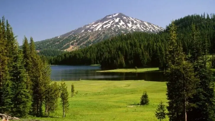
8. Sparks Lake Hike (Ray Atkeson Loop Hike)


Named after one of Oregon’s most famous landscape photographers, the Ray Atkeson (1907-1990) Loop Hike (aka Sparks Lake Hike) is a short, 2.6-mile loop around the beautiful Sparks Lake.
The trail starts at the Ray Atkeson Trailhead, at which point you’ll start walking into a lodgepole pine forest in the foothills below Mount Bachelor and the Three Sisters. From here, you walk on a mostly flat track to the south and east of Sparks Lake with great views of the surrounding landscape, making this a fine choice for a quick family outing into the mountains.
Distance: 2.6 miles
Elevation Gain: 165 feet
Difficulty: Easy
Learn more here
9. Farewell Bend River Trail Loop


Located in the heart of the city of Bend, this casual walking trail takes you on a nice 1.1-mile loop around Farewell Bend. Starting in Farewell Bend Park, you can pick up the mostly flat trail and head out on an easy stroll in town during your lunch break or on a Sunday morning after brunch.
Low-commitment and great for families and pups, alike, the Farewell Bend River Trail is a popular walking, running, and road biking destination for the residents of Bend, Oregon.
Distance: 1.1 miles
Elevation Gain: 13 feet
Difficulty: East
Learn more here
Up Next In Hiking:
Gorilla Glue for Shoe Soles? (Hiking Shoe Quick Fix)
10 Best Waterfall Hikes near Portland, Oregon
10 Incredible Hikes in Colorado That Will Change Your Life
Top 20 Best Day Hikes in the World


David is an accomplished mountain endurance athlete who has completed over 25 ultra marathon races (follow on Strava). He is most proud of his finish at The Drift 100 – a high elevation, 100 mile winter foot race that zigzags along the Continental Divide in Wyoming. In the future he hopes to compete in the ITI 350 and ultimately the full 1,000 mile Iditarod Trail Invitational that follows the same path as the historic dog sled race.
Leave a comment
You must be logged in to post a comment.